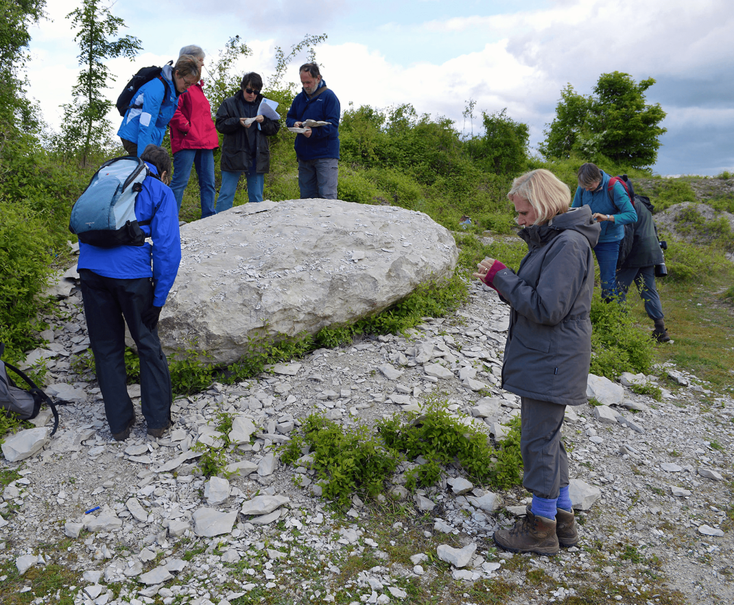
Rocks in Bedfordshire
The rocks of Bedfordshire, indeed of southern Britain as a whole, are of sedimentary origin. This section describes the various rock types seen throughout the county, the oldest of which, Jurassic in age, are up to 200 million years old, overlain by younger Cretaceous rocks. They formed in ancient seas as layers of sand, clay and lime-rich sediment on the sea bed. This process of settling under gravity imparted their chief characteristic of horizontal layering or bedding. However, this process was by no means continuous, being periodically interrupted by periods of uplift and erosion, leading to time gaps in the rock succession.
Tilting and folding by movements of the Earth's crust during the Tertiary, brought these rocks towards the Earth's surface, many millions of years after they were initially deposited. They were then subject to processes of weathering and erosion by water and ice, fashioning them into the landscapes we see today.
Of particular significance are the most recent deposits that accumulated over the last 2.6 million years, during periods of marked climatic changes known collectively as the Quaternary ‘Ice Age’. These deposits are often quite thin, but their influence on the landscape is profound and they generally provide the parent material on which soils develop.
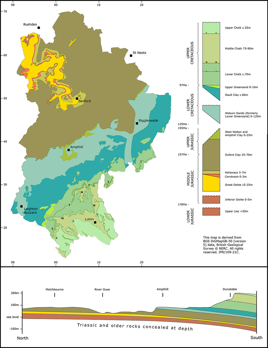
This pattern of sedimentary rocks at or near the present land surface is best illustrated on a bedrock geological map - see below. The oldest rocks remain deeply buried and are known only from borehole or geophysical records, but by combining all this information it is instructive to visualise the entire sequence as a stratigraphical column and as a cross-section - effectively a vertical slice through the countryside.
Tilting and folding by movements of the Earth's crust during the Tertiary, brought these rocks towards the Earth's surface, many millions of years after they were initially deposited. They were then subject to processes of weathering and erosion by water and ice, fashioning them into the landscapes we see today.
Of particular significance are the most recent deposits that accumulated over the last 2.6 million years, during periods of marked climatic changes known collectively as the Quaternary ‘Ice Age’. These deposits are often quite thin, but their influence on the landscape is profound and they generally provide the parent material on which soils develop.
This pattern of sedimentary rocks at or near the present land surface is best illustrated on a bedrock geological map - see below. The oldest rocks remain deeply buried and are known only from borehole or geophysical records, but by combining all this information it is instructive to visualise the entire sequence as a stratigraphical column and as a cross-section - effectively a vertical slice through the countryside.
The Jurassic Period
The oldest exposed rocks in Bedfordshire are those of the Upper Lias, comprising a series of silty muds and muddy limestones that were laid down in the sea around 190 million years ago (Ma). This sea was warm, well-oxygenated and teemed with life, including abundant ammonites.
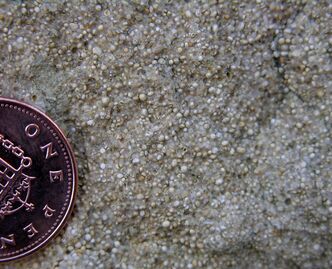
Uplift and subsequent erosion means there is a time gap between the Upper Lias and the overlying rocks of the Inferior Oolite, deposited around 175 Ma. The Inferior Oolite contains tiny balls of calcite (calcium carbonate) that tell us the environment was a warm, shallow sea. Waves rolled the particles backwards and forwards on the sea floor, giving them an even coating of calcite. Both these ancient formations crop out in tiny areas on either side of the River Ouse.
The younger Great Oolite is another oolitic limestone formed in warm, shallow waters. Ammonites, sea urchins and bivalves are common fossils in this rock. It can be found at the surface along the valley sides of the River Ouse between Bromham and Milton Ernest, and also between Harrold and Felmersham. The Great Oolite is a good building stone and many of the north Bedfordshire villages provide excellent examples of its use.
Oolitic limestone
|
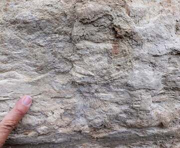
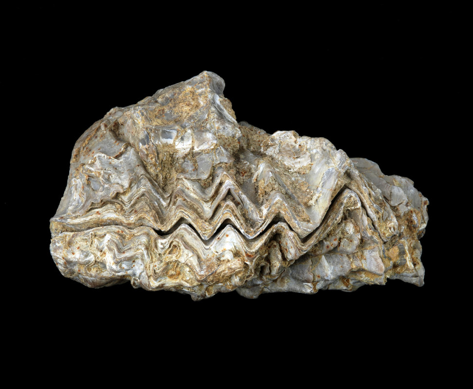
Close up of Cornbrash limestone in the walls of Bromham Bridge
|
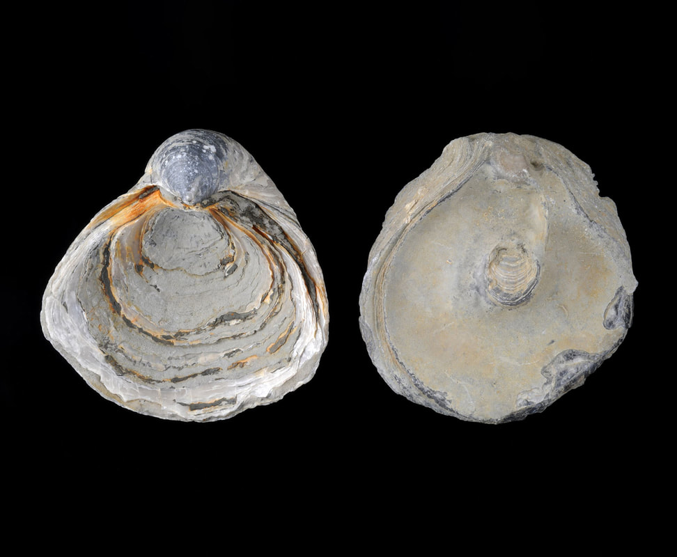
Fossil oyster Lopha marshii from the Cornbrash, Bromham. Specimen length 10cm
|
The Cornbrash is a creamy-yellow, thinly bedded, rubbly limestone containing lots of completely smashed fossil shells, the result of strong wave action near a shoreline about 170 Ma. In Roman times it was occasionally used as a roofing material, but it is not a good building stone. However, it does make a fertile, well-drained soil (hence the name Cornbrash - ‘a site where good corn is grown’).
The Oxford Clay and West Walton & Ampthill Clay record a deepening of the Upper Jurassic sea. The Oxford Clay is well known for its diverse assemblage of marine fossils, including ammonites, the unusually curved oyster Gryphaea and large reptiles such as ichthyosaurs and plesiosaurs.
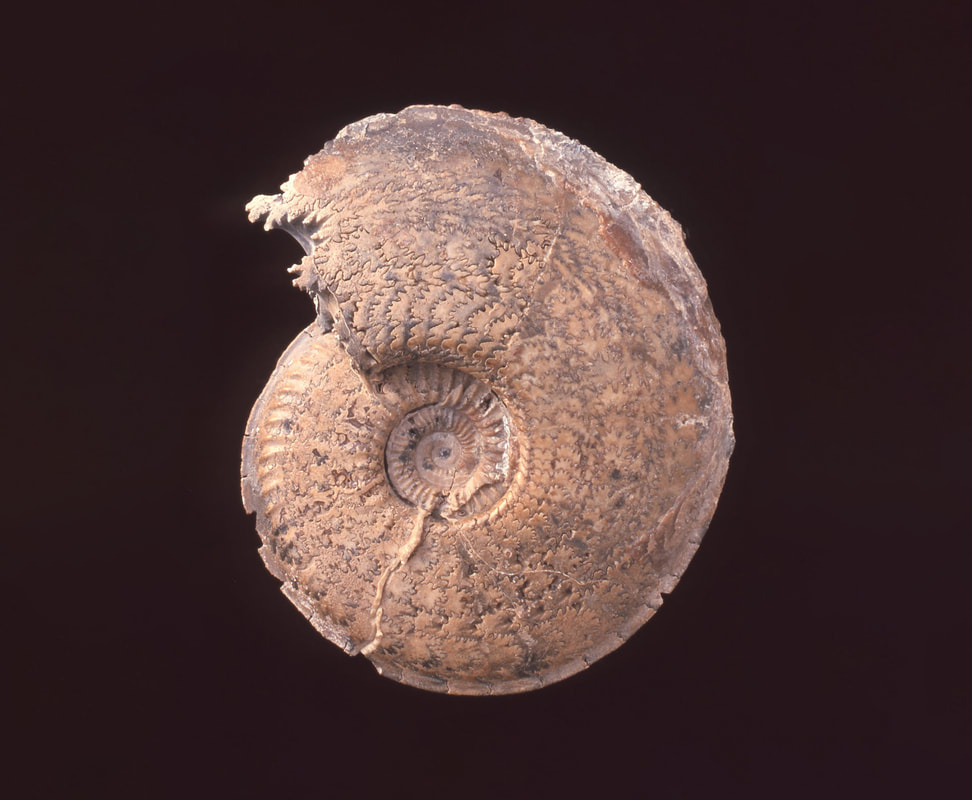
Amoeboceras serratum, an ammonite from the Oxford Clay. Specimen 10cm across
|
Lower and upper valves of Gryphaea dilatata, an oyster from the Oxford Clay. Specimen 8cm across
|
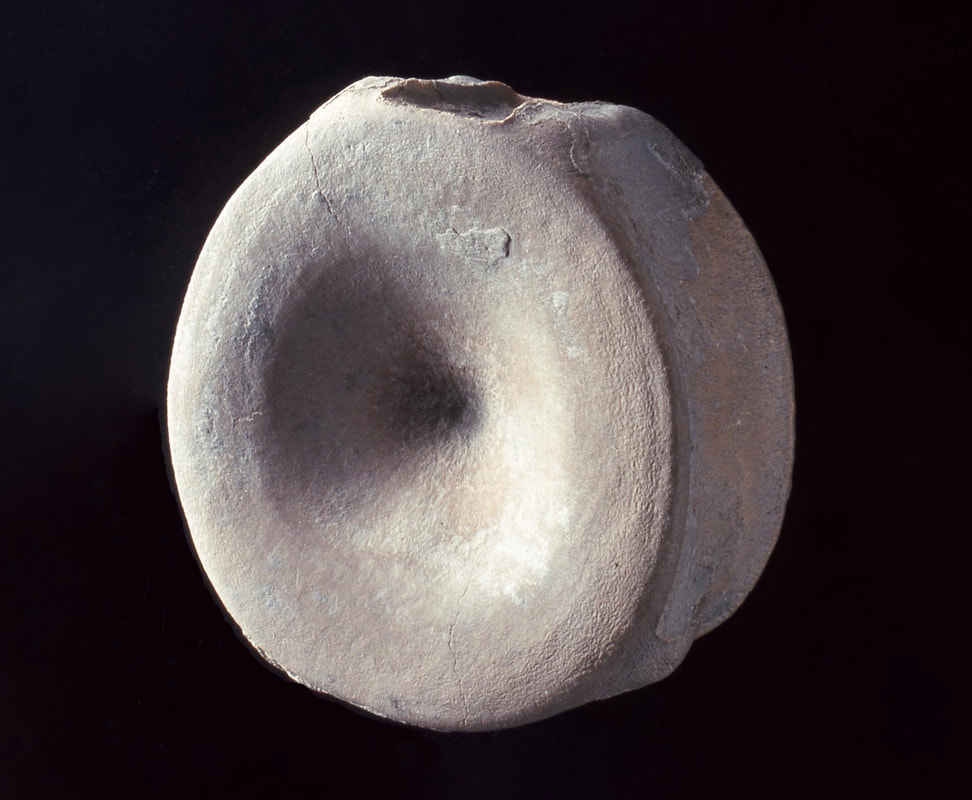
Ichthyosaur vertebra – note its concave centre. Specimen 6.5cm across
|
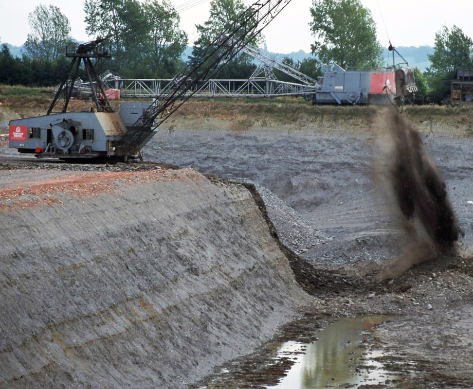
Extraction of Oxford Clay for brick making, Quest Pit, Stewartby
|
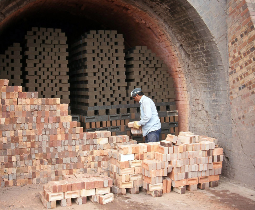
Organic-rich ‘green’ bricks being loaded for firing in kilns - note the fired bricks used for sealing up the entrance to the kiln
|
The Cretaceous Period
The Greensand Ridge, which forms a prominent feature across the middle of the county, is an outcrop of the Woburn Sands Formation (formerly the Lower Greensand), a geological unit named after the village of Woburn Sands, near Milton Keynes.
These sands were laid down in a seaway around 120 Ma, during Early Cretaceous times. This was an exciting episode in Bedfordshire’s geological history, for having been dry land for about 30 million years, the area was then flooded again by the sea. A narrow tidal channel running southwest from the Wash, across Bedfordshire, and onward to the Isle of Wight, formed as a result of rising sea level caused by global warming.
These sands were laid down in a seaway around 120 Ma, during Early Cretaceous times. This was an exciting episode in Bedfordshire’s geological history, for having been dry land for about 30 million years, the area was then flooded again by the sea. A narrow tidal channel running southwest from the Wash, across Bedfordshire, and onward to the Isle of Wight, formed as a result of rising sea level caused by global warming.
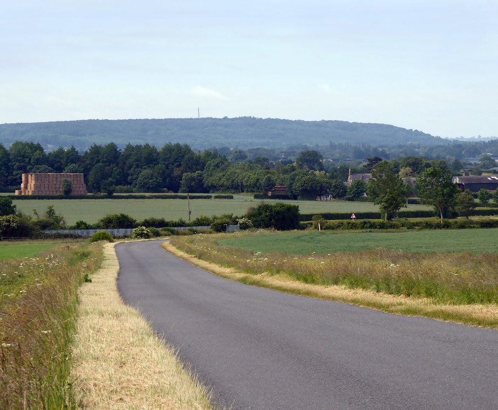
A view of the Greensand Ridge of Woburn Sands, from Cranfield
|
Cross-stratification in the Woburn Sands Formation, Potton
|
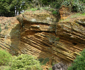
Cross-stratification in the Woburn Sands Formation, Kiln Lane Quarry, Clophil
|
Another unconformity separates the Woburn Sands Formation from the overlying Gault Clay. The Gault Clay represents a return to deeper, open water conditions as the climate continued to warm and southern England was progressively submerged beneath the sea. Great thicknesses of bluish-grey clays were deposited, containing abundant marine fossils such as ammonites and bivalves.
The Gault Clay and the Upper Greensand are very poorly exposed in Bedfordshire because they are generally covered by glacial deposits, but they form the low-lying clay vale that runs from Wrestlingworth to Leighton Buzzard. Excellent examples of the Upper Greensand can be seen in the walls of Husborne Crawley church.
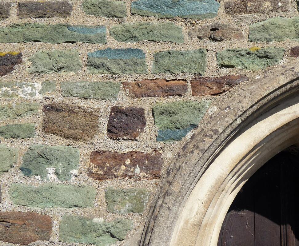
Blocks of Upper Greensand in the walls of Husborne Crawley church
|
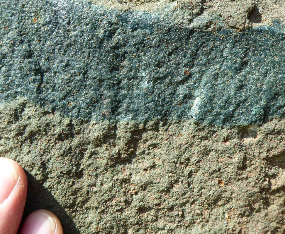
Close up of Upper Greensand in the walls of Husborne Crawley church
|
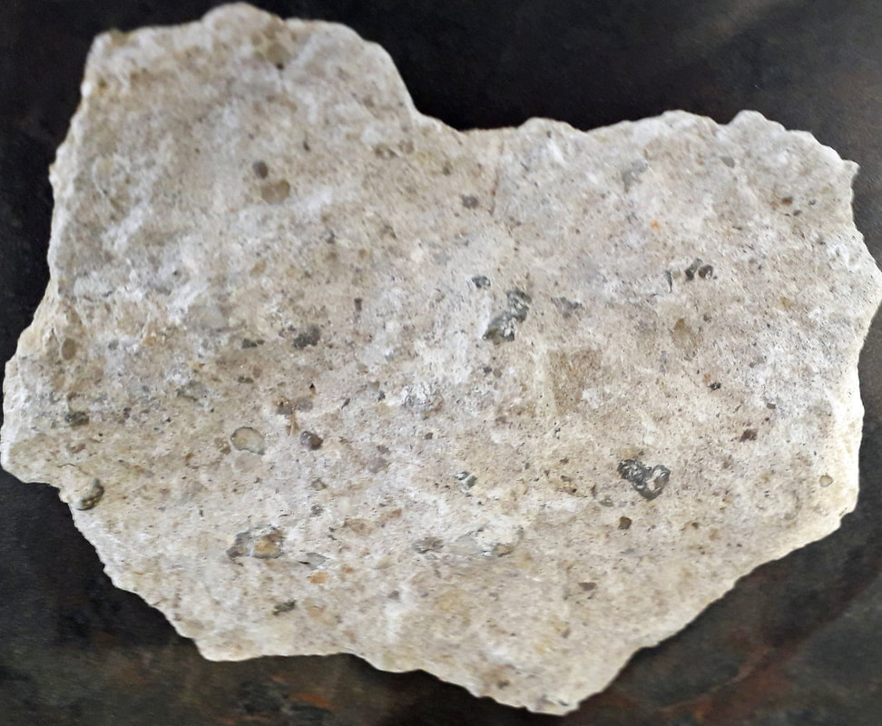
Totternhoe Stone with phosphatic nodules. Specimen 19cm across
|
The Chalk is an unusual and distinctive rock that produces the best of Bedfordshire’s scenery, for example Dunstable Downs and the Chilterns. It is a particularly pure limestone made largely of the remains of tiny, single-celled, planktonic algae which accumulated as vast thicknesses of soft coccolith ooze on the Late Cretaceous sea floor. Coccoliths are minute (~2-10 micrometres) calcite plates derived from these single-celled algae; these plates form the vast bulk of the Chalk.
Horizons of flint nodules and silicified fossils occur commonly within the Upper Chalk. Flint formed as nodules during early diagenesis within the Chalk sediment. Flint is composed of silica (SiO2), in the form of microcrystalline quartz, derived mainly from siliceous sponges (and to some extent radiolarians and diatoms) that accumulated in the soft coccolith ooze of the Late Cretaceous sea floor.
Being made of silica, these dead organisms tended to dissolve with time in the alkaline environment of the calcareous sediment around them, on and under the sea floor. The dissolved silica then reprecipitated on encountering localised acidic conditions caused when hydrogen sulphide gas (H2S) from decaying organic matter met oxygen in aerated water in animal burrows and other permeable parts of the sediment. Flints often have such strange shapes because the silica precipitated out preferentially in the vicinity of these burrows, replacing the calcium carbonate (calcite) there which went into solution. Being composed of hard silica, the highly resistant flint tends to persist long after weathering and erosion of the original Chalk.
Being made of silica, these dead organisms tended to dissolve with time in the alkaline environment of the calcareous sediment around them, on and under the sea floor. The dissolved silica then reprecipitated on encountering localised acidic conditions caused when hydrogen sulphide gas (H2S) from decaying organic matter met oxygen in aerated water in animal burrows and other permeable parts of the sediment. Flints often have such strange shapes because the silica precipitated out preferentially in the vicinity of these burrows, replacing the calcium carbonate (calcite) there which went into solution. Being composed of hard silica, the highly resistant flint tends to persist long after weathering and erosion of the original Chalk.
The Tertiary Period
Towards the end of the Cretaceous, around 65 Ma, uplift affected Britain, gently folding the Jurassic and Cretaceous rocks. Most of the British Isles became land, although parts of southern Britain were occasionally flooded by the sea.
In Bedfordshire the Early Tertiary deposits probably comprised thin sands and clays laid down by rivers that drained eastwards across a low-lying marshland. Historically, a small remnant of that deposit was recognised in the vicinity of Slip End, near Luton, but it was extracted for brick making in the 19th century and is no longer evident. Nor is there any remaining evidence of younger Tertiary deposits because this was a period of ongoing uplift during which deep chemical weathering occurred under a warm and humid climatic regime. At the same time major river systems began to erode deeply into the underlying Chalk.
In Bedfordshire the Early Tertiary deposits probably comprised thin sands and clays laid down by rivers that drained eastwards across a low-lying marshland. Historically, a small remnant of that deposit was recognised in the vicinity of Slip End, near Luton, but it was extracted for brick making in the 19th century and is no longer evident. Nor is there any remaining evidence of younger Tertiary deposits because this was a period of ongoing uplift during which deep chemical weathering occurred under a warm and humid climatic regime. At the same time major river systems began to erode deeply into the underlying Chalk.
The Quaternary Period
The legacy of the Quaternary in Bedfordshire is out of all proportion to its duration. Lasting only about 2.6 million years, this dynamic time period is characterised by a number of alternating cold (glacial) and warm (interglacial) climatic phases, with the cold ones being far more long-lasting.
Periglacial ice wedges, Biddenham
|
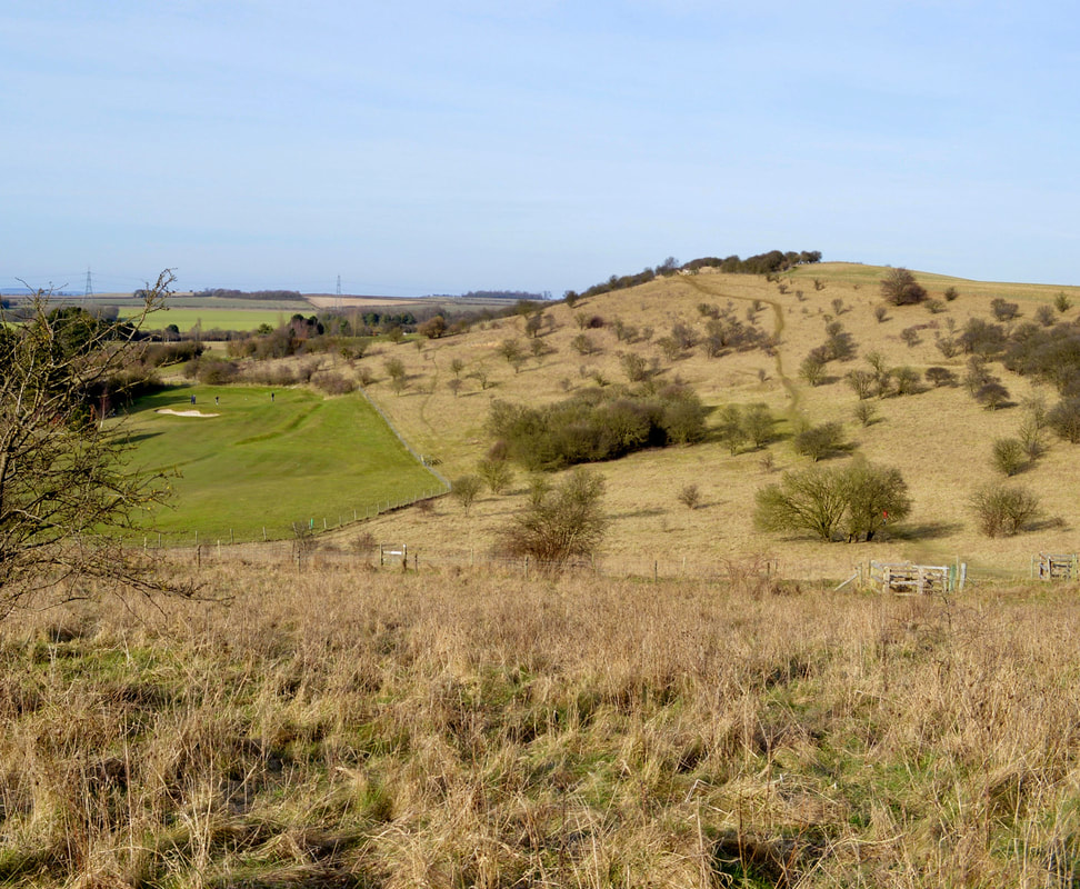
Chalk hill, Galley Hill near Luton
|
As Quaternary sediments are relatively thin and blanket the underlying bedrock they are often referred to as superficial deposits, so do not feature on the bedrock geological map. Their distribution is complicated by the fact they occur in a variety of topographic settings. For example, glacial deposits may infill a pre-existing river valley and suppress the topography, or accumulate on the high ground between river valleys (interfluves) and accentuate it. The principal types of superficial deposit in Bedfordshire are best represented on the Drift version of the geological map - see below - and are described thereafter.
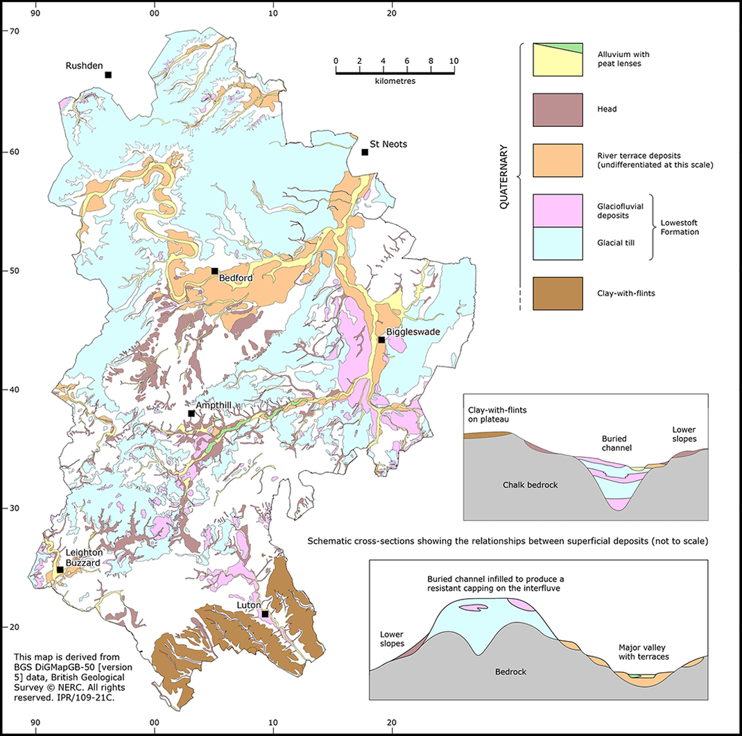
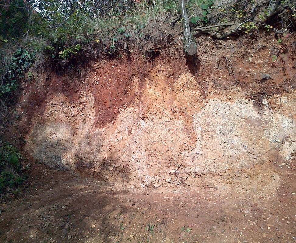
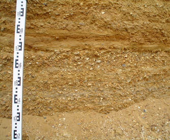
The oldest deposits are Clay-with-flints and they occur as a dissected capping overlying the dip-slope of the Upper Chalk outcrop around Luton. Generally less than 10 metres thick, they are composed of orange-brown or red-brown clays and sandy clays containing abundant flint nodules and pebbles. Clay-with-flints probably formed through the in situ alteration of Late Cretaceous and Early Tertiary deposits by soil-forming and periglacial processes over a very long time period before the Anglian glaciation.
Subsequently, as the Anglian ice sheet advanced and retreated it deposited thick sequences of blue-grey clay containing clasts of chalk, flint, quartzite, some Jurassic limestone and reworked Jurassic fossils. Historically this type of deposit was called ‘boulder clay’ although now the term glacial till is preferred. The clay and silt content of the till is derived almost entirely from local erosion of the Oxford Clay. In contrast, many of the coarser clasts come from further afield; the chalk and flint originate from the Lincolnshire Wolds and East Anglia, the quartzite pebbles from the Midlands, and occasional ‘exotic’ rocks have been transported by the ice sheet from as far away as Scandinavia.
Glacial till is the most extensive of the superficial deposits in Bedfordshire. Only the highest chalk hills are free from of a cover of till and this is because the Anglian ice sheet flowed around them, occupying the low ground and exploiting natural ‘gaps’ such as that at Hitchin. The till thickness is highly variable, partly reflecting the undulating nature of the pre-Anglian landscape, but also the magnitude of subsequent erosion and weathering. Where the till has not been eroded by subsequent periglacial and fluvial processes it may be tens of metres thick, as on the undulating, elevated plateau north of Bedford. Isolated remnants of till also contribute significantly to the subtle topography of the county by forming low hills within the clay vales, as at Pulloxhill and Tebworth.
Sporadic, discontinuous bodies of sand and gravel occur beneath, within and on top of the till and these are interpreted as glaciofluvial deposits, dumped by meltwater streams flowing through and around the margins of the Anglian ice sheet. These two glacial deposits are distinguished on the map, but the complex relationship between them is more clearly expressed in the schematic cross-sections.
Thin but extensive sand and gravel deposits that occur along the valley of the Great Ouse and its tributaries - the Ivel, Flit and Ouzel - are regarded as river terrace deposits. They are typically recognised in the field as a series of flattish ‘benches’ or terraces in the valley sides and are grouped according to their elevation above the present-day floodplain.
Terraces represent the eroded remnants of older floodplain deposits and they formed in several stages during the 400 thousand years since the retreat of the Anglian ice. As the rivers shifted laterally they reworked and eroded the Anglian till and glaciofluvial deposits, progressively creating as much as 50 metres of valley topography. Fossils found in the terrace deposits indicate that this lowering of the local landscape occurred under a range of climatic conditions that varied from warm, through cool temperate to cold.
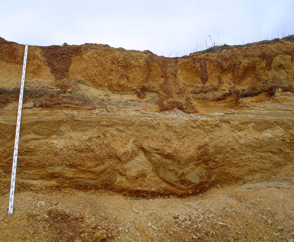
Glaciofluvial sands and gravels, showing ice wedges at top, Broom Quarry
|
Close up of glaciofluvial deposits,
Broom Quarry
|
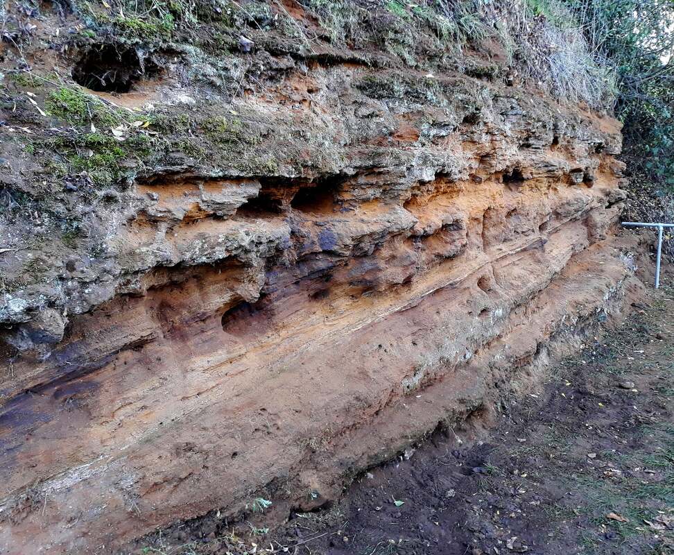
Head is a heterogeneous deposit derived from mass downslope movement of material mainly under periglacial conditions. Most head deposits are believed to have originated during the latest (Devensian) glacial episode that lasted from about 115,000 -10,000 years ago, compounded since then by soil creep and hill wash during the current temperate climate. The composition of head closely reflects the upslope deposits from which it has formed; thus the Woburn Sands Formation gives rise to head comprising sandy silts and clays with clasts of ironstone and varying amounts of flint gravel.
Head has not been mapped systematically across the county but it can be assumed that a thin veneer is widely present, particularly on the lower slopes and floors of valleys. Thicker and older (pre-Anglian) head deposits occur in the dry valleys or coombes of the Chalk escarpment. Here material from the Clay-with-flints has spread downhill and been preserved as a chalky loam in the valley bottoms because they lay beyond the erosive limit of the Anglian ice sheet.
Head has not been mapped systematically across the county but it can be assumed that a thin veneer is widely present, particularly on the lower slopes and floors of valleys. Thicker and older (pre-Anglian) head deposits occur in the dry valleys or coombes of the Chalk escarpment. Here material from the Clay-with-flints has spread downhill and been preserved as a chalky loam in the valley bottoms because they lay beyond the erosive limit of the Anglian ice sheet.